

MOUNT SINAI
For more than two thousand years there was one place and one place alone which was considered to be Mount Sinai. Today it seems to be almost a fad to proclaim some new location as the “true Mount Sinai.” Non-scientific methods are being utilized to prove each “new discovery” and books are sold by the millions. They unashamedly claim the traditional Mount Sinai was a story made up by Christians around 500 AD. However there is much to be said about ancient oral traditions and ancient writings which boldly point toward the traditional Mount Sinai (Jebel Musa/Ras Safsafa) in the Sinai Peninsula. This is also the only place which fits with the scriptures of the Holy Bible. I will now attempt to provide convincing material that the traditional Mount Sinai was not made up by Christians in 500 AD and that Mount Sinai has always been in “Sinai.”
The earliest references to Jebel Musa as Mount Sinai and/or Mount Sinai as being located in the present day Sinai Peninsula are inconclusive. There is evidence that prior to 100 AD, well before the Christian monastic period, Jewish sages had already identified Jebel Musa as Mount Sinai. Graham Davies of Cambridge University offers evidence that early Jewish pilgrimages had already identified Jebel Musa as Mount Sinai and this identification was later adopted by the Christian pilgrims.[1][2] Harrison states that, “Jebel Musa . . . seems to have enjoyed special sanctity long before Christian times, culminating in its identification with Mt. Sinai.” [3] In the second and third centuries BC Nabateans were making pilgrimages there, which is indicated in part by inscriptions discovered in the area.[4]
Josephus places Mount Sinai between Egypt and Arabia, reflecting the standard rabbinical belief which must have been even older. Ancient Rabbinic literature describes Mt. Sinai as being the exact distance and location from Paran as Egeria who, around 381-384, recorded the distance to Jebel Musa.
We can safely say the earliest Judaic placement of Mount Sinai at Jebel Musa was between 100 BC to 30 AD.
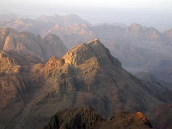
. . . . . . . . . . . . Mount Sinai—Jebel Musa. At the very top a small chapel sits over the spot where Moses is said to have communed with God and where stone was cut out for the 10 Commandments. A rock sits on the summit which is believed to be where God descended and upon which Moses stood. This is widely held to be one of the holiest mountains in the world.
Josephus wrote that “Moses went up to a mountain that lay between Egypt and Arabia, which was called Sinai.” He says that Sinai is “the highest of all the mountains thereabout,” and again is “the highest of all the mountains that are in that country, and is not only very difficult to be ascended by men, on account of its vast altitude but because of the sharpness of its precipices.” [5] The traditional Mount Sinai/Horeb, located in the Sinai Peninsula, is actually the name of a collection of peaks, sometimes referred to as the Holy Mountain peaks [6] which include the peaks of Jebel Musa, Mount Ras Safsafa, and the adjacent Mount Katherine.
Etheria wrote, “The whole mountain group looks as if it were a single peak, but, as you enter the group, [you see that] there are more than one.” [7] Josephus must have been referring to these peaks as Mount Sinai which are indeed the highest in the country between Egypt and Arabia.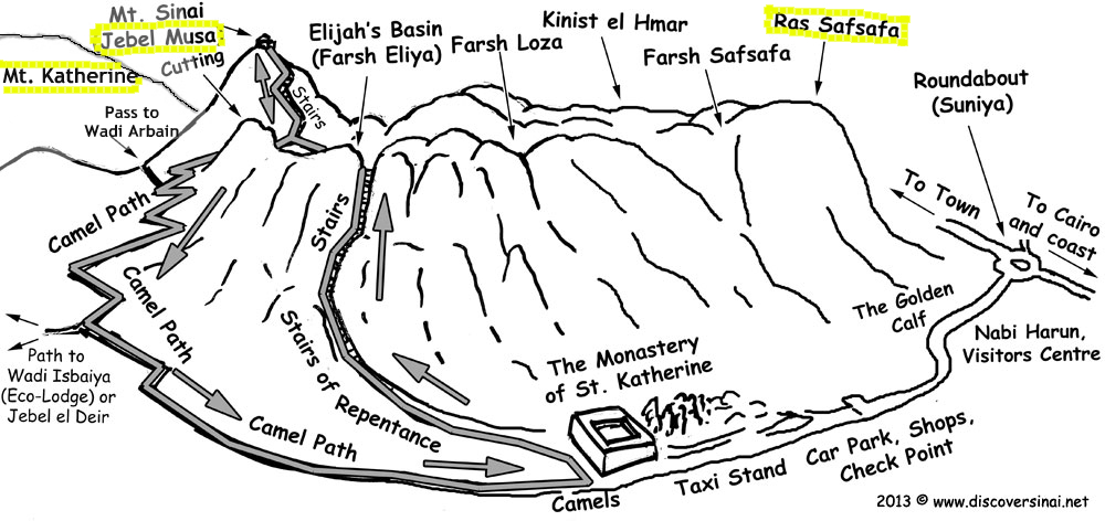
The highest mountain peak is Mount Katherine, rising 8,550 ft. above the sea and it’s sister peak, Jebel Musa (7,497 ft.), is not much further behind in height, but is more conspicuous because of the open plain called er Rachah (“the wide”). Mount Katherine and Jebel Musa are both much higher than any mountains in the Sinaitic desert, or in all of Midian.
The highest tops in the Tih desert to the North are not much over 4,000 ft. Those in Midian, East of Elath, rise only to 4,200 ft. Even Jebel Serbal, 20 miles West of Sinai, is at its highest only 6,730 ft. above the sea.[8]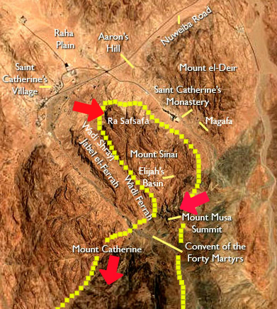
Many scholars believe that Mount Sinai was of ancient sanctity prior to the ascent of Moses [9] Scholars have theorized that Sinai in part derived it’s name from the word for moon which was “sin” (meaning “the moon” or “to shine”). [10] Antoninus Martyr provides some support for the ancient sanctity of Jebel Musa by writing that Arabian heathens were still celebrating moon feasts there in the 6th century. [11] Eckenstien states that some of the artifacts discovered indicate that “the establishment of the moon-cult in the peninsula dates back to the pre-dynastic days of Egypt.”[12] She says the main center of moon worship seems to have been concentrated in the southern Sinai peninsulu which the Egyptians seized from the Semitic people who had built shrines and mining camps there. [13]
Inscriptions with pictures of moon worship objects are found all over the southern peninsula. “The Sinaite inscriptions,” says Dr. Robinson, “are found on all the routes which lead from the west towards Sinai, as far south as Tûr. They extend to the very base of Sinai, above the Convent el-Arba’in: but are found neither on Jebel Musa nor on the present Horeb, nor in St. Catherine, nor in the valley of the Convent; while on Serbal they are seen on its very summit.”[12] It is quite odd that inscriptions and moon votive objects appear on most every mountain in the peninsula except for that of the very mountain which tradition identifies as ‘Mount Sinai.” This oddity may suggest that the mountain was “cleansed” of pagan votives and idols and inscriptions when the sacred mountain was dedicated solely to Yahweh. Such action is consistent throughout the Bible (ie, II Chron. 34:3-7, Exodus 32:20).
Deuteronomy 12:2-3 instructs, “Ye shall utterly destroy all the places, wherein the nations which ye shall possess served their gods, upon the high mountains, and upon the hills, and under every green tree: and ye shall overthrow their altars, and break their pillars, and burn their groves with fire; and ye shall hew down the graven images of their gods, and destroy the names of them out of that place.”
WHERE THE ISRAELITES CAMPED AROUND SINAI
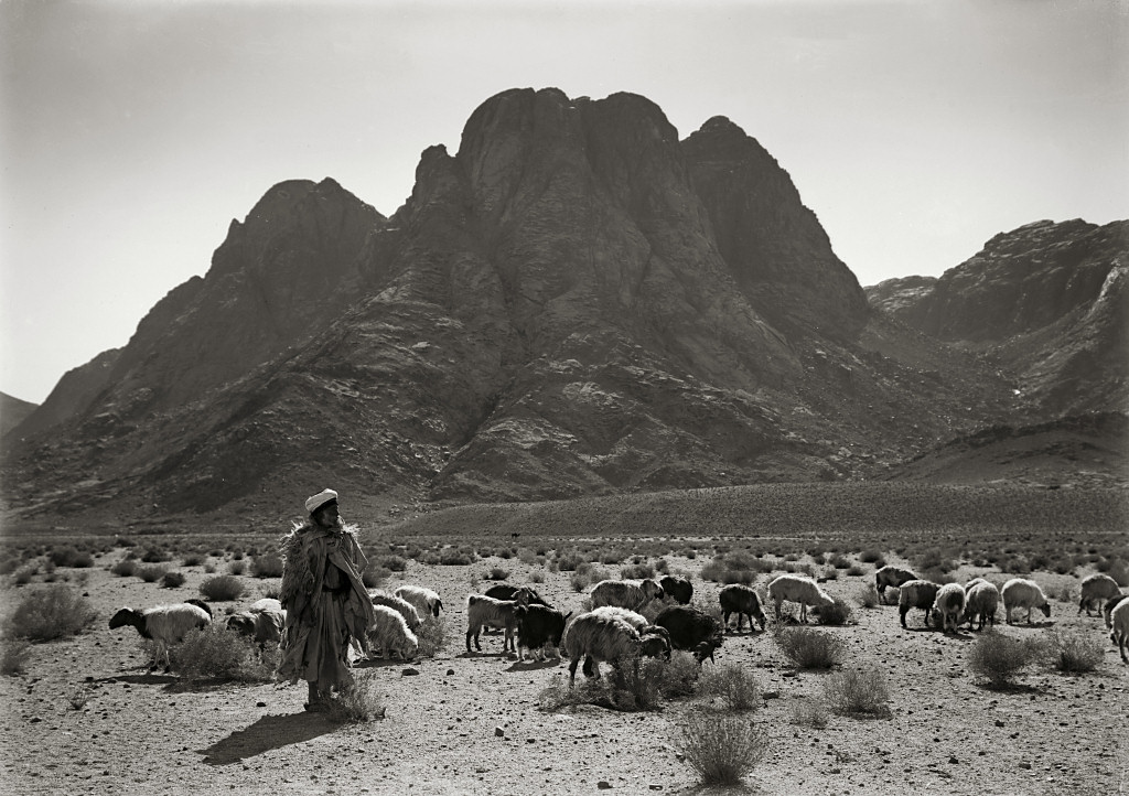
Groups of nawamis have been discovered in southern Sinai, creating a kind of ring around Jebel Musa . [17] The nawamies were used over and over throughout the centuries for various purposes. Etheria , circa the 4th/5th century A.D., noted that her guides, who were the local “holy men”, pointed out these round or circular stone foundations of temporary huts claiming the children of Israel used them during their stay there. [18]
The southern Sinai Peninsula .contains archaeological discoveries but to place them with the exodus from Egypt is a daunting task inasmuch as the dates of the Exodus vary so widely. The Exodus has been dated from the Early Bronze age to the the Late Iron Age II [19][20] with most fundamentalists pointing toward the late Bronze age.
The presence of Egyptian pottery in the Southern Sinai during the Late Bronze and Early Iron I (Ramesside) periods have been discovered at the mining camps of Serabit el-Khadim and Timna. Objects which bore Proto-Siantic inscriptions, same as those found in Canaan, were discovered at Serabit el Khadim in the Southern Sinai. Several of these were dated in the later bronze age. [21]
These encampments provide evidence of miners from Southern Canaan. [22] The remote site of Serabit el-Khadem was used for a few months at a time, every couple of years at best, more often once in a generation. The journey to the mines was long, difficult and dangerous. [23]
HANDWRITING IN STONE FROM ISRAELITES ENSLAVED BY EGYPTIANS

. . . . . . . . . . . . . . . . . . . . . . . . . “El, Save Me!
Jacobovici, Adjunct Professor of Religious Studies at Huntington University, affiliate of Laurentian University in Sudbury and Investigative Journalist, deciphered some of these inscriptions as, “El, Save me!” and “O El, save me from these mines” suggesting these etchings were made while the Israelites were enslaved in Egypt.
Expeditions headed by Professor Mazar examined the tell of Feiran, the principal oasis, of southern Sinai and discovered the site abounded not only in Nabatean sherds but in wheel-burnished sherds typical of the kingdom of Judah, belonging to Iron Age II. [24]
One suggestion has been made that the shaking of the mountain was due to “electrico-volcanism” which they believe exists in the area. To unbelievers descriptions in Exodus 19:19, 20:18 and Judges 5:4 could be read to suggest plasma phenomenon, such as ball lightning or Saint Elmo’s fire, connected with mountain thunderstorms. The closest thing in nature resembling the Biblical descriptions is an isolated supercell mountain storm. These are often accompanied with a pillar of red sprite burst and red lightning. However, this does not describe how these natural phenomenon could speak with Moses and give him the ten commandments!!! It does not explain how the very finger of God could write upon stone! Even today strange sounds have blasted from Jebel Musa in the absence of a storm. Stanley referred to “the mysterious noises which have from time to time been heard on the summit of Jebel Musa.” It was reported that the monks at Jebel Musa “had originally settled on the highest peak, but were by these strange noises driven down to their present seat in the valley.”
Edward Robinson insisted that the Plain of ar-Raaha adjacent to Jebel Musa could have. accommodated the Israelites. Edward Hull stated that, “this traditional Sinai in every way meets the requirements of the narrative of the Exodus.” Hull agreed with Robinson and stated he had no further doubts after studying the .great …. amphitheater leading to …. the base of the granite cliff of Ras Sufsafeh, that here indeed was the location of the camp and the mount from which the laws of God was delivered to the encampment of Israelites below. [25]
F. W. Holland stated (Recovery of Jerusalem, 524): “With regard to water-supply there is no other spot in the whole Peninsula which is nearly so well supplied as the neighborhood of Jebel Musa . . . There is also no other district in the Peninsula which affords such excellent pasturage.” [26]
Calculating the travels of the Israelites the Bible Atlas states, “These distances will not, however, allow of our placing Sinai farther East than Jebel Musa.” [27]
Some point to the absence of material evidence left behind in the journey of the Israelites but Dr. Beit-Arieh wrote, “Perhaps it will be argued, by those who subscribe to the traditional account in the Bible, that the Israelite material culture was only of the flimsiest kind and left no trace. Presumably the Israelite dwellings and artifacts consisted only of perishable materials. [28]
Hoffmeier wrote, “None of the encampments of the wilderness wanderings can be meaningful if the Israelites went directly to either Kadesh or Midian . . . a journey of eleven days from Kadesh to Horeb can be properly understood only in relationship to the southern portion of the Sinai Peninsula. “ [29]
Local beduins who have long inhabited the area have identified Jebel Musa as Mount Sinai. How long this identification has been adhered by them is lost in antiquity. In the fourth century AD small settlements of monks set up places of worship around Jebel Musa. An Egyptian pilgrim named Ammonius, who had in past times made various visits to the area identified Jebel Musal as the Holy Mount in the 4th century. Empress Saint Helena, ca. 330 A.D. built a church for humanitarian reasons to protect monks against raids from nomads who were murderous thieves. She chose the site for the church from the identification which had been handed down through generations through the beduins. She also reported the site was confirmed to her in a dream.[30]
By Dr. C.D. Ward
In my next article on Mount Sinai I will present hitherto ignored archaeological findings from the Jebel Musa/Ras Safsafa southern Sinai area. Also presented will be evidence that Mount Sinai and Mount Paran were not the same mountain (see Deuteronomy 33:2 and Numbers 10:12). Mount Sinai is located in the southern Sinai peninsula and Mount Paran is located in Arabia and may very well be the Jabal el-Lawz mountain. Finally I will present numerous scriptural proofs of the correct location for the true Mount Sinai.
(More pictures and very interesting information can be found after the references below)
References
- Davies, Wilderness (1979) pp. 23-24
- Mount Sinai, Joseph J. Hobbs, University of Texas Press, Feb 19, 2014 – Social Science
- Bible Encyclopedia, R. K. HARRISON J. K. HOFFMEIER
- Theological Dictionary of the Old Testament, Volume 10, edited by G. Johannes Botterweck, Helmer Ringgren, Heinz-Josef Fabry , Page 235
- Josephus, Flavius, The Antiquities of the Jews II, xii, 1; III, v, 1
- http://www.touregypt.net/featurestories/mountsinai.htm#ixzz2vZeRh9hD
- Landscapes of Interesting Localities Mentioned in the Holy Scriptures, By John Marius Wilson, Edward Francis Finden, William Finden, Pg.36
- The Encyclopaedia Britannica: A Dictionary of Arts & Sciences, edited by Hugh Chisholm Volume 25, pg. 139
- A History of Sinai, Eckenstien, Lina, London S.P.C.K., pg 1, 1921
- A History of Sinai, Eckenstien, Lina, London S.P.C.K., pg 13, 1921
- ^ Jump up to:a b p. 66-67. “Timna.” Geraldine Pinch. Votive Offerings to Hathor. Oxford. Griffith Institute, Ashmolean Museum. 1993
- Ewald, Hist. ii. 43, 45, 103; Di.; W. R. Smith, Rel. Sem.2 p. 117 f.; Sayce, EHH.188; DB. iv. 536b; Burney, Journ. of Theol. Studies, ix. (1908), p. 343 f.; and others
- tin. c. 38
- p. 306. “Conclusion.” Joseph J. Hobbs. Mount Sinai. Austin, Texas. University of Texas Press. 1995. ISBN 0-292-73091-8
- Dr. Robinson’s Biblical Researches, vol. i., p. 188
- Against Apion, 2:2 [2:5]
- .Lina Eckenstein, A History of Sinai (London & New York, 1921 [AMS Press, New York, 1980 reprint]) pp. 99 fn. 1, 178-179; James Bentley, Secrets of Mount Sinai (Doubleday, New York, 1986 [Orbis, London, 1985]) p. 58; Edith Deen,Great Women of the Christian Faith (Harper & Row, New York, 1959 [Barbour & Co., Westwood, N.J., reprint]) pp. 7-10
- Griffith, Sidney Harrison, Julian Saba, ‘Father of the Monks’ of Syria, Journal of Early Christian Studies 2 (1994): 185-216
- International Standard Bible Enclylopedia, 1911 Edition: Written by C. R. Conder.
- The History of Redemption By Nancy Mahusay
- Davies, Wilderness (1979) pp. 63, 109
- ^ Jump up to:a b http://www.centre4sinai.com.eg/nawamis.htm
- Bimson, John J., Livingston, David. “Redating the Exodus.” Biblical Archaeology Review, Sep/Oct 1987, 40-48, 51-53, 66-68.
- Rendsburg, Gary A., The Bible and the Ancient Near East, pg 171
- pp.63-5. Itzhaq Beit-Arieh. “Canaanites and Egyptians At Serabit el-Khadim.” Anson F. Rainey, editor. Egypt, Israel Sinai; Archaeological and Historical Relationships In The Biblical Period. Tel Aviv, Israel. Tel Aviv University. 1987
- John Bright, A History of Israel (Westminster Press, Philadelphia, 1959) pp. 114-115
- http://archaeology.tau.ac.il/?page_id=2206
- Beit-Arieh, 1981, pp. 17-18
- p.166, Yohanan Aharoni, “Kadesh-Barnea and Mount Sinai.” Beno Rothenberg. God’s Wilderness, Discoveries in Sinai. New York. Thomas Nelson & Sons.1961, 1962
- Andrews University Seminary Studies, Spring 1987, Vol. 25, No. 1, 73-96
- Seargent, David A.J., Weird Weather: Tales of Astronomical and Atmospheric Anomalies
- Josephus, Flavius, The Antiquities of the Jews, II, xii, 1; III, v, 1
- http://www.touregypt.net/featurestories/mountsinai.htm#ixzz2vZeRh9hD
- Grazia, Alfred De, vol.9: God’s Fire, Ch. 3: Catastrophe and Divine Fires
- Stanley, Dean, Sinai and Palestine, ed. 1868, pp. 13, 14
- Nature , international weekly journeal of scince, 54, 8-8 (07 May 1896) | doi:10.1038/054008b0
- “Desert of the Exodus,” vol. i. pp. 217, 251
- Proceedings of the Royal Geographical Society, Volumes 13-14, pg 216
- Mount Sinai, Joseph J. Hobbs, University of Texas Press, Feb 19, 2014 – Social Science
- http://bibleatlas.org/mount_sion.htm
- Davies, GrahamThe Way of the Wilderness: A Geographical Study of the Wilderness, pg 77
- http://bibleatlas.org/mount_sion.htm
- Beit-Arieh 1988: 37
- http://bibleatlas.org/mount_sion.htm
- Bible Encyclopedia, R. K. HARRISON J. K. HOFFMEIER
“The text of this website [or this page, or this section] is available for modification and reuse under the terms of the Creative Commons Attribution-Sharealike 3.0 Unported License and the GNU Free Documentation License (unversioned, with no invariant sections, front-cover texts, or back-cover texts)” so that certain articles or portions or these articles found on this website may be used by the author (CWatchman or Dr. C.D. Ward) in Wikipedia articles.
__________________________________________________________
MOLD FOR THE GOLDEN CALF AT MOUNT SINAI
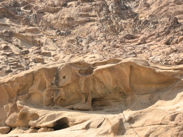
Ancient local legend says that an imprint of a calf was the mold used by the ancient Israelites to shape a “Golden Calf” while Moses was at the peak. That mold can be seen in the photo above. The television documentary, Mysteries of the Bible, spoke of this phenomenon saying,
“Of all the sites to be seen at Jebel Musa perhaps none is more mysterious nor more compelling that this might well be Mount Sinai than the strange completely natural rock formation at the foot of the mountain. It is a haunting image, evocative of a young bull, especially mystifying when we recall that while Moses was away on the mountain for 40 days receiving the 10 commandments Aaron and the Israelites constructed their infamous idol–the golden calf down below. So perhaps this was the spot.”
[46]http://discoversinai.net/english/places-of-interest-egypt-sinai/st-catherine-and-mt-sinai/
[47]http://www.youtube.com/watch?v=xgDNQ5zF04g
_________________________________________________________
PORTRAIT OF MOSES IN THE SINAI PENINSULA

Looking at the southern Sinai Peninsula, on Google Maps, you can see a a figure that looks like Moses.
It appears in the center of the picture above. You can see the shape of a man, with eyes, nose, beard, etc, looking toward the right.
It is been said that this is the portrait of Moses looking over to Israel.
It looks as though he is sitting or standing on Mount Sinai (Jebel Musa) with his robe draped over the area as he looks over the Holy Land.
If in doubt of this picture simply go see it for yourself on Google Maps at: Southern Sinai Peninsula.
One must admit this is quite a chilling anomaly!
_________________________________________________________
SCORCHING OF MOUNT SINAI (JEBEL MUSA)
A green arrow at the bottom right hand corner of the above aerial map shows Mount Sinai (Jebel Musa) as a scorched, black area, in comparison with the surrounding mountainous area. In stark contrast as a testimony to the other mountains of the area it immediately brings to mind the Holy Scriptures which say:
“…And the mountain burned with fire unto the midst of heaven, with darkness, clouds, and thick darkness.”
…….Deuteronomy 4:11
” And the LORD spake unto you out of the midst of the fire: ye heard the voice of the words, but saw no similitude; only ye heard a voice. And he declared unto you his covenant, which he commanded you to perform, even ten commandments; and he wrote them upon two tables of stone.”
……Deuteronomy 4:12-13
[49] Deut.4:11, 12-13
__________________________________________________________
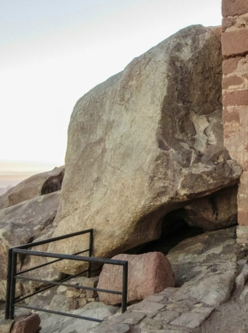
ROCK OF MOSES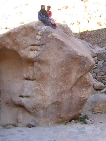
The rock that is believed to be from which Moses fetched water. The twelve clefts on it, according to local tradition, represent the twelve springs described in another ancient manuscript. Locals claim that on occasion water will still flow from the rock.
[50]http://www.somedayillbethere.com/2012/05/above-of-egypt-climbing-mount-sinai-advice/
_________________________________________________________
THE BURNING BUSH

An ancient legend maintains that the bush near the mount is the original burning bush from which the Angel of the Lord spoke unto Moses. It is a rare species of the rose family called Rubus Sanctus. It is said that this is the only bush of its kind growing in the entire Sinai Peninsula, and that every attempt to transplant a branch of it to another place has been unsuccessful. The bush is native to Sinai and extremely long-lived, facts that help lend credibility to the site.
Aetheria, a 4th century pilgrim from Spain, tells us of his visiting this site: “We had to advance deep into the valley for there are many hermit cells and a shrine at the site of the Bush. The Bush is verdant to this day. This is the Bush of which I have spoken earlier, the one from which God in a flame of fire spoke to Moses. The Bush is in a very beautiful garden in front of the Church.”
The bush is also described in literature from the 10th century.
Some maintain that if even if this evergreen bush was not the same bush it is nevertheless from the same stock as the burning bush from which God spoke to Moses.
Pilgrims enter the chapel near the Burning Bush without shoes, in remembrance of the commandment of God to Moses, “Put off thy shoes from off thy feet, for the place whereon thou standest is holy ground” (Ex. 3:5). [46]
[47]http://www.geographia.com/egypt/sinai/burningbush.htm
__________________________________________________________
IMPRINT OF THE BURNING BUSH LEFT ON GRANITE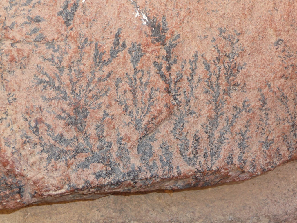
Stones near the burning bush bear fossil-like markings which are engraved in the granite rock. It is said that it was here where the the miraculous fire of God appeared in the bush and God spoke to Moses.
Local guides explain that fossils cannot be seen in any granite stone, only limestones. Mt. Sinai is mainly made up of granite stones. These are NOT fossils which appear in the granite stone. They explain that since God touched the mountain itself (when he gave Moses the 10 commandments), and spoke to him through the Burning Bush, the fossil like imprint appeared on the stones which look just like the Burning Bush.
It seems that many believe that the patterns were caused by a divine light, so intense that the shadows of the plant were imprinted in the stone leaving the imprint which are identical to the leaves of the Burning Bush. It may be explained that the powerful spiritual radiation of the fire of God left it’s print in the rock like radiation from an x-ray machine leaves images on x-ray plates.
One rabbi commented that the stones were branded by God with internal engravings of bush-like shapes in memory of the incident of the burning bush that allegedly took place there. He wrote:
“The Mysterious Rocks from Mount Sinai: No matter how you split a rock from Mount Sinai, you will see on all sides mysterious engravings of a bush. I’ve witnessed this personally and can testify that it’s true. (this is a unique phenomena in the world) I once heard an explanation in the name of a Midrash: ‘ When G-d sent Moses to Egypt to report to the Jews about the redemption and then to come back to Mount Sinai, Moses asked G-d: ‘how will I be sure which mountain to return to?’ (since at first, G-d spoke to Moses only from Mount Sinai). G-d made a miracle and all the rocks from Mount Sinai became engraved with the ‘burning bush’.” (Rabbi Binyamin Levin at: dafyomirreview.com)
The Jewish Midrash says the rocks would be engraved as a sign. While geological dendrite type features may appear in other parts of the world, this exact form does not appear anywhere in this area except for that of Mount Sinai. Other candidates alleging to be Mount Sinai have no such sign engraved in their stones. It would stand to reason the midrash is saying, “Don’t search in India or any other ridiculous places in the world for Mount Sinai . . . look in the Sinai Peninsula and then look for the autograph God put on it.” Local Beduins, who know the peninsula intimately, attest no such autograph appears in any other mountain in the peninsula. No other mountain stones behave as Mount Sinai stones.
It is not mandatory that these stones be a geographically or a radiation unique caused phenomenon. Since the omnipotent, omnipresent God fills all nature it is not impossible that he could have caused dendrite crystals formations by filling minute fissures in the rocks with mineral solutions such as iron or manganese. The burst of great light from the bush or the quaking of the mountain could have produced fissures and the later rainstorms, recorded in scripture, could have filled them. A rainbow is meteorological phenomenon that is caused by both reflection and refraction of light in water droplets but it is still it is still a miracle and a scriptural promise created by God.
So what is the answer? They could be nothing but a scientific oddity. They may not be connected to Moses at all. But there are too many unanswered questions and too many coincidences for us to make a snap judgement on this unique finding right at this time.
It is a very interesting subject with a long history that remains unexplained.
[47]http://www.geographia.com/egypt/sinai/burningbush.htm
__________________________________________________________
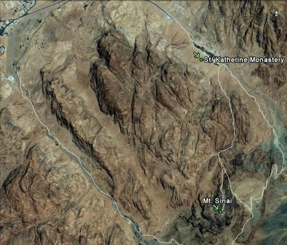
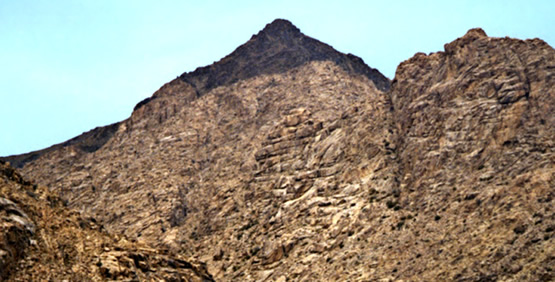
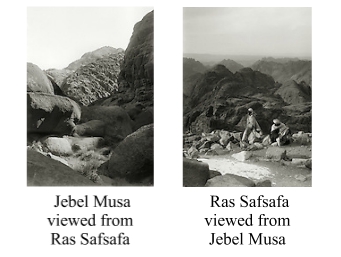
THE PEAKS OF MOUNT SINAI/HOREB
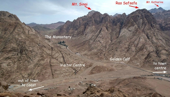
Josephus wrote that “Moses went up to a mountain that lay between Egypt and Arabia, which was called Sinai.” He says that Sinai is the highest of “the mountains that are in that country, and is not only very difficult to be ascended by men, on account of its vast altitude but because of the sharpness of its precipices.” The traditional Mount Sinai/Horeb, located in the Sinai Peninsula, is actually the name of a collection of peaks, sometimes referred to as the Holy Mountain peaks.
On the south side of Sinai/Horeb is Jebel Musa. On the north side is Ras Safsafa. They are two peaks of the same mountain. Behind Ras Safsafa you can see the peak of Mount Katherine.
Etheria wrote, “The whole mountain group looks as if it were a single peak, but, as you enter the group, [you see that] there are more than one.” Josephus must have been referring to these peaks as Mount Sinai which are indeed the highest in the country between Egypt and Arabia.
__________________________________________________________
WHERE MOSES HEARD FROM GOD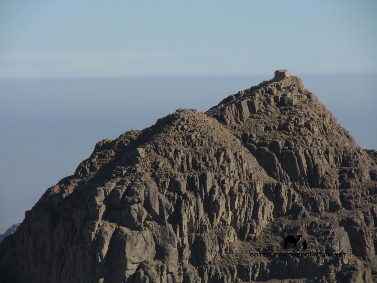
At the very top right of the mountain peak is the place where Moses is supposed to have communed with God. A small chapel is built over the area and there is a place cut in the rock where the original stone for the ten commandments was said to have been taken from. This is the summit of Mount Sinai which the locals call Jebel Musa. This is widely held to be one of the holiest mountain peaks in the world.
This is the Southern peak of Mount Sinai/Horeb.
__________________________________________________________
WHERE MOSES SPOKE AND THE ISRAELITES CAMPED
Ras Safsafa—The Northern peak of Mount Sinai/Horeb
This is the side of Mount Sinai/Horeb on which Moses may have read the ten commandments to the children of Israel. The plain in front of it is called The Plain of er-Raha. This may be where some of the Israelites camped at the bottom of the mountain while Moses was up on the summit of Jebel Musa communing with God.
While some refer to this side as Horeb, Horeb is actually believed to be the whole mountain, including Ras Safsafa, while the south peak, Jebel Musa, is the specific Mount Sinai.*
The children of Israel’s encampment may have extended southeast from the foot of this mountain to the foot of Jebel Musa. There is plenty of room around the mountain peaks for a multitude of people to camp.
This is the northern peak of Mount Sinai/Horeb.
*Jeffery, David L., A Dictionary of Biblical Tradition in English Literature, Horeb, 1992, Literary Criticism
__________________________________________________________
MOUNT PARAN
Jebel al-Lawz is located in the area of ancient Paran. Moses prayed on more than one mountain in his long journey. (Deut 33:2) Geographically they had to have been separate mountains. I believe Mount Sinai to be Jebel Musa, and Mount Paran to perhaps be Jebal al-Lawz.
Notice that Jebel al-Lawz has a charred mountaintop the same as Jebel Musa has.
_________________________________________________________
THE ROCK WHERE GOD & MOSES STOOD

This is traditionally held to be the rock on which God in his glory descended to speak to Moses and where God stood to give the ten commandments.
Moses is believed to have stood on the rock at a later point.
This is the highest peak on Mount Sinai.
“And the Lord said, Behold, there is a place by me, and thou shalt stand upon a rock.” (Exodus 33:20-23)
__________________________________________________________
THE CLEFT IN THE ROCK WHERE MOSES HID
This is believed to be the cleft in the rock where Moses was hidden as God’s glory passed by.
The imprint of Moses’ back, head, and hand are said to be imprinted in the rock.
“The rock on which Moses stood, and in the cleft of which he was sheltered, was doubtless an emblem of Christ; in whose person, character, and salvation alone, sinners may by faith see the glory of God, and live; for there it appears in softened splendour; as the sun, when his brightness is diminished by a mist, is beheld more distinctly by the human eye.” (–Scott)
“And he said, Thou canst not see my face: for there shall no man see me, and live. And the Lord said, Behold, there is a place by me, and thou shalt stand upon a rock: And it shall come to pass, while my glory passeth by, that I will put thee in a clift of the rock, and will cover thee with my hand while I pass by: And I will take away mine hand, and thou shalt see my back parts: but my face shall not be seen.” (Exodus 33:20-23, KJV)
And when my glory shall pass, I will set thee in a hole of the rock, and protect thee with my right hand, till I pass. (Ex 33:22, Douay-Rheims Bible)
_________________________________________________________
THE ROCK WHERE GOD & MOSES STOOD,
THE CLEFT IN THE ROCK WHERE MOSES HID,
AND THE CAVE WHERE MOSES PRAYED
This is a different angle of the rock traditionally believed to have been where God stood, where Moses later stood, and underneath is believed to have been the cleft Moses was hidden in. This is also believed to be the cave where Moses prayed and waited for The Ten Commandments.
“And the Lord said, Behold, there is a place by me, and thou shalt stand upon a rock: And it shall come to pass, while my glory passeth by, that I will put thee in a clift of the rock, and will cover thee with my hand while I pass by.” (Exodus 33:20-23)
__________________________________________________________
A PRAYER GROUP ON MOUNT SINAI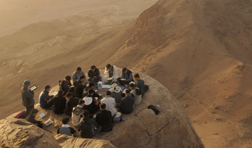
I hope no one starts shouting and dancing!
__________________________________________________________
THE WELL OF MOSES
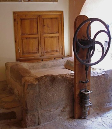
According to tradition, this is the well of Moses.
__________________________________________________________
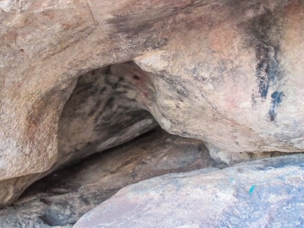
THE CAVE OF MOSES AND ELIJAH

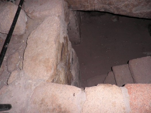
These are two views of the same cave where it is believed Moses and Elijah lodged for 40 days on Mount Sinai (the cleft in the rock is the cave where Moses prayed and waited for The Ten Commandments, while this cave is where he and Elijah respectively dwelled).
“And the LORD said unto Moses, Write thou these words: for after the tenor of these words I have made a covenant with thee and with Israel. And he was there with the LORD forty days and forty nights.” (Exodus 34:27,28)
“And he arose, and did eat and drink, and went in the strength of that meat forty days and forty nights unto Horeb the mount of God. And he came thither unto a cave, and lodged there; and, behold, the word of the LORD came to him, and he said unto him, What doest thou here, Elijah? And after the earthquake a fire; but the LORD was not in the fire: and after the fire a still small voice. And it was so, when Elijah heard it, that he wrapped his face in his mantle, and went out, and stood in the entering in of the cave. And, behold, there came a voice unto him, and said, What doest thou here, Elijah?” (I Kings 19:8,9,12,13)
__________________________________________________________
MOUNT SINAI VIEWED FROM BOTH PEAKS
__________________________________________________________
You may read my article which reveals what wilderness the children of Israel actually wandered in:
The Children of Israel’s Wandering in the Wilderness
__________________________________________________________
You may read my article about Saint Catherine’s Monastery at:
__________________________________________________________
In the future I will be writing much more on this subject. I hope I have convinced you in something which was presented here that Mount Sinai IS in Sinai.
__________________________________________________________
Longer version below:
===The Sinai Peninsula===
The earliest references to Jebel Musa/Ras Safsafa as Mount Sinai and/or Mount Sinai as being located in the present day Sinai Peninsula are inconclusive. There is evidence that prior to 100 CE, well before the Christian monastic period, Jewish sages had already identified Jebel Musa as Mount Sinai. Graham Davies of Cambridge University offers evidence that early Jewish pilgrimages had already identified Jebel Musa as Mount Sinai and this identification was later adopted by the Christian pilgrims. He argues that around 100 CE that rabbinical literature described the distance between Pharan and Mt. Sinai as 36 Roman miles, almost exactly matching the later figures of Egeria (who visited Jebel-Musa around 381-384) of 35 Roman miles Pharan-to-Jebel Musa.[1][2] Harrison states that, “Jebel Musa . . . seems to have enjoyed special sanctity long before Christian times, culminating in its identification with Mt. Sinai.[3] In the second and third centuries BCE Nabateans were making pilgrimages there, which is indicated in part by inscriptions discovered in the area.[4]
Antoninus Martyr provides some support for the ancient sanctity of Jebel Musa by writing that Arabian heathens were still celebrating moon feasts there in the 6th century. Scholars have theorized that Sinai in part derived it’s name from the word for moon which was “sin” (meaning “the moon” or “to shine”)[5] The etymology of the name Sinai may indicate that the mountain was “holy” even before the time of Moses. Since the etomology of the word “sinai” is believed by scholars to be derived from the word for moon and moon worship then wherever the original Mount Sinai was located would most likely be a place of moon cult. Therefore to locate the placement of the original mount one should study an area in which moon worship was most prevalent.
Eckenstien claims that in antiquity the Sinai peninsula was a center of moon cult. The word “sin” appears in 3700 BC in the name of Naram-Sin who was king of Accad in Babylonia. His actions were compared with lunar cycles. His annals state “the moon was favourable for Naram-Sin who at this season marched into Maganna.” Eckenstien believes that Maganna refers to Sinai.[6] The main center of moon worship seems to have been concentrated in the southern Sinai peninsula which the Egyptians seized from the semitic people who had built shrines and mining camps there.[7] Monuments and artifacts have been discovered in the southern Sinai peninsula in the temple ruins of Sarbut-el-Khadem, Serabit and Maghara. Eckenstien writes that “Maghara more especially was associated with the moon-god and was presumably the site of a shrine” during “Arabic influence which preceded the invasion of the peninsula by the Egyptians.” She says”Egyptians associated their moon-god with the moon worship of the peninsula.”[6] She states that some of the artifacts indicate that “the establishment of the moon-cult in the peninsula dates back to the pre-dynastic days of Egypt.”[7]
Dr. Geraldine Pinch (PhD) says that some figurines, bowls and pottery which has been discovered at Timnah could date to the 18th dynasty. She also suggests that religious offerings were being made during this time.[8]
Many scholars believe that Mount Sinai was of ancient sanctity prior to the acsent of Moses [9] The Sinai peninsula has an ancient history of being a center of a moon cult and was sacred to ancient moon worshipers. It stands to reason that a mountain with such a name as Sinai would most likely be situated in such an area as the Sinai Peninsula. Placentinus describes how c.570 a.d. a white marble idol, representing the moon-god, was still being worshiped on the traditional Sinai by the native Arabs at every new-moon.[10] Ancient Arabs and Egyptians would have christianed a sacred moon mountain with the name of Sinai which is the name we find the sacred mountain of Moses was named. The descendants of the ancient area Arabs are the modern bedoiuns whose consistent legends and oral history points toward Jebel Musa as the original Mount Sinai. It would stand to reason that although Moses received a “revelation”of monotheism, which both he and Israel did not consider a moon-god, that the well known name Mount Sinai nevertheless retained the name ingrained in the minds of the locals. Hobbs writes about the “banana-shaped”rise at the southern end of the plain of er Raha [11] which actually seems to be more of a moon cresent shape.
Inscriptions with pictures of moon worship objects are found all over the southern peninsula. “The Sinaite inscriptions,” says Dr. Robinson, “are found on all the routes which lead from the west towards Sinai, as far south as Tûr. They extend to the very base of Sinai, above the Convent el-Arba’in: but are found neither on Gebel Mousa nor on the present Horeb, nor in St. Catherine, nor in the valley of the Convent; while on Serbal they are seen on its very summit.”[12] Yahweh had expressly forbidden idols or other objects to be used in worship. It is quite odd that inscriptions and moon votive objects appear on most every mountain in the peninsula except for that of the very mountain which tradition identifies as ‘Mount Sinai.” This oddity may suggest that the mountain was “cleansed” of pagan votives and idols and inscriptions when the sacred mountain was dedicated solely to Yahweh. Such action is consistent throughout the Bible (ie, II Chron. 34:3-7, Exodus 32:20 ).
Egyptologist Geraldine Pinch says that some figurines, bowls and pottery which has been discovered at Timnah could date to the 18th dynasty. She also suggests that religious offerings were being made during this time.[8]
In the first century (60 AD) Josephus reflects the standard rabbinic belief concerning the location of Mount Sinai when he writes “Moses went up to a mountain that lay between Egypt and Arabia, which was called Sinai”[13] which appears to be the geographic Sinai Peninsula. He provides other evidence which leads to Jebel Musa (see above).
Elijah made a prilgrimage to Mount Sina in the era of 1 Kings (I Kings 19:18). Local beduins who have long inhabited the area have identified Jebel Musa as Mount Sinai. How long this identification has been adhered by them is lost in antiquity. In the fourth century AD small settlements of monks set up places of worship around Jebel Musa. An Egyptian pilgrim named Ammonius, who had in past times made various visits to their area identified Jebel Musal as the Holy Mount in the 4th century. Empress Saint Helena, ca. 330 A.D. built a church for humanitarian reasons to protect monks against raids from nomads who were murderous thieves. She chose the site for the church from the identification which had been handed down through generations through the beduins. She also reported the site was confirmed to her in a dream.[14]
Julian Sabian built a church there c 360 Ad.[15]
During Justonians rein (527- 565) he established the presence of of St Catherines monastry on the NW slope of Mount Jebel to replace a church which was built there two centuries earier.
In 542 Justian 1 built a a fortress-like basilica to protect the church form wandering mauraders. Legend says Saint Catherines body was transported miraculously by a band of angels to Katrina and her supposedly uncorupted body was removed to the monastery where her remains rest there to this very day.
Mohahammed, prophet to Islam and believer of Jebel Musa as the true Mount Sinai, gave his personal pledge of protection to the monastery and to the three mounts and his pledge is honored to this very day.
The Israeli occupation of Jebel Musa of 1967 resulted in a paved road to Jebel Musa for Pilgrims who wished to travel to the the sacred mountain which was believed to be Mount Sinai.[16][17] It was not until Lepsius’ proposal in 1845 that any other specific mountain but the traditional Jebel Musa was ever suggested for Mt. Sinai.[18] So, we have no other contenders for the title of Mount Sinai except for Jebel Musa during the impressive span of time from around 100 BC to 1845 AD.
Nine groups of nawamis have been discovered in southern Sinai, creating a kind of ring around Jebel Musa (Mt. Moses).[19]These circular buildings were constructed using sandstone slabs. It is thought that the Nawamis were probably ancient burial chambers but no one knows the identity of the people buried there. There are more than 30 Nawamis next to the road from Nuweiba to St. Catherine’s Monastery. These ancient dwellings of unknown origin have been reused for many centuries. They are like stone igloos in appearance. Dating of the nawamis is difficult because they have been disturbed consistently through the ages. This means that our dates for the nawamis remain somewhat speculative. Many were built around 4,500 BC by nomadic herders and are the worlds oldest remains of a pastoral nomadic society. The nawamis were used over and over throughout the centuries for various purposes. They were used as burial places and centuries later used again for burial purposes for other deceased persons. One nawami contained a skeleton less than 100 years old.[19] They were used in various times throughout history as huts or temporary homes from the elements. Red Sea shell bracelets were found in some of them which are are known from the Chalcolithic period (c. 4500-3500 B.C.) site of Tell Abu Matar, near Beer-Sheva, Israel, and from the Chalcolithic/Early Bronze sites (late fourth millennium B.C.) of Bab edh-Dhra in Jordan and Tell el-Farah (North) on the West Bank of Palestine. As stated, the Nawamis were used over and over throughout the centuries as burial places or as circular huts in which to dwell in. A pilgrimess, called Etheria or Egeria, circa the 4th/5th century A.D., kept a diary of her visit to Mount Sinai, and she noted that her guides, who were the local “holy men, pointed out round or circular stone foundations of temporary huts, and they pointed out first the place where the camp of the children of Israel stood in the days of Moses when he went up the mountain … then they showed how each and every one of them had dwellings, the foundations which are still visible today throughout the valley, and how they had been built in a circular shape out of stone.” (p. 57. George E. Gingas [Translator]. Egeria: Diary of a Pilgrimage.New York, N.Y. & Mahwah, New Jersey. The Newman Press. 1970)She affirmed the Israelites lived in these nawamis which surround Jebel Musa.
The southern Sinai Peninsula contains archaeological discoveries but to place them with the exodus from Egypt is a daunting task inasmuch as the projected dates of the Exodus vary so widely. The Exodus has been dated from the Early Bronze age to the the Late Iron Age II [20][21] with most fundamentalists pointing toward the late Bronze age.
The presence of Egyptian pottery in the Southern Sinai during the Late Bronze and Early Iron I (Ramesside) periods have been discovered at the mining camps of Serabit el-Khadim and Timna. Objects which bore Proto-Siantic inscriptions, same as those found in Canaan, were discovered at Serabit el Khadim in the Southern Sinai. Several of these were dated in the later bronze age.[22] Regardless of the date of the exodus the Israelites could have either left or passed the Egyptian mining camps without problem. Bright says they could have easily avoided “collision with Egyptian troops, for the Egyptians did not maintain a permanent garrison at the mines. Except at intermittent periods when mining parties were at work, the Hebrews could have passed unmolested.” [23]
The remote site of Serabit el-Khadem in Sinai is home to a remote temple which “was used for a few months at a time, every couple of years at best, more often once in a generation…The journey to the mines was long, difficult and dangerous: the miners suffered from thirst, wild beasts, and snakes. The Egyptians felt the need for divine aid in their efforts, and built a shrine…Later kings expanded the shrine, as was the custom in Egypt, adding more rooms, more monuments, more gods. Many expeditions generated their own specific monument, a commemorative stela engraved with text and symbolic pictures. Sometimes the expedition leader and other participants also erected monuments of their own.” [24] There is an ancient mountain graveyard which the Arabs refer to as Bounli Abou Israel. There are many Proto-Sinaitic inscriptions at Serabit. One of the inscriptions carries “the name El (God) and may well be the earliest West Semitic inscription of the divine name.”[25]
Expeditions headed by Professor Mazar examined the tell of Feiran, the principal oasis, of southern Sinai and discovered the site abounded not only in Nabatean sherds but in wheel-burnished sherds typical of the kingdom of Judah, belonging to Iron Age II.[26] The name of a Biblical character, Hobab, appears in a late bronze age inscription which “favors the southern route through Sinai for the Exodus.”[27]
Attempts to identify Mount Sinai as a volcano have not led to anything substantial and would not apply to the southern Sinai Peninsula. Yet critics seem to persist in looking for natural phenomenon to explain the spiritual. They usually exempt Jebel Musa because it was not volcanic. However, they seem to miss the fact that it could have been a conductor of plasma phenomenon. I am going to play the devil’s advocate for a few moments to describe a natural phenomenon on Jebel Musa missed by critics. It is true Jebel Musa was not volcanic. However, high and lofty peaks such as those around Jebel Musa have been known to emit plasma phenomenon such as ball lightning or St. Elmo’s fire which has been reported by the locals in connection with storms and rainfall. Plasma phenomenon is a weather phenomenon in which luminous plasma is created by a coronal discharge from a sharp or pointed object in a strong electric field in the atmosphere such as those generated by thunderstorms.[28] Josephus wrote of Mount Sinai saying, “because of the sharpness of its precipices: nay, indeed, it cannot be looked at without pain of the eyes.”[29]Some Bedouins in the area asert the name Sinai came from the Arabic word for “tooth” (sinn) because the jagged peaks resemble the the teeth through which the mouth of God spoke. Richard Pococke supposed that the twin peaks might have been likened unto nurturing human breasts in the Persian “sine.” The traditional Mount Sinai/Horeb, located in the Sinai Peninsula, is actually the name of a collection of sharp peaks, (Jebel Musa, Ras Sufsafeh, with Jebel Katherina adjacent to the twin peaks) and are sometimes referred to as the Holy Mountain peaks. [30]
For example the sharp twin peaks of Jebal Musa and Mount Saint Katherines is only 1 minute or 0.2 miles apart. Thunderstorm clouds may suddenly form, lasting for days, are apt to cap very lofty mountains and produce plasma phenomonon through sharp peaks. Grazia writes, “The discharge will seek outlets through tooth-like (Sinai=Sinn=Tooth?), sword-like (Horeb=sword), and especially quartz-loaded eminences.” [31] Descriptions in Exodus 19:19, 20:18 and Judges 5:4 could be read to suggest plasma phenomenon connected with mountain thunderstorms. Strange sounds have blasted from Jebel Musa even in the absence of a storm. Stanley refered to “the mysterious noises which have from time to time been heard on the summit of Jebel Musa.” [32] It was reported that the monks at Jebel Musa “had originally settled on the highest peak, but were by these strange noises driven down to their present seat in the valley.”[33] An Arabian legend attributes the loud sounds on Jebel Musa “to a fairy maiden, who fires off a gun one day in every year to give notice of her presence.”[34]It is believed these sounds result from some disturbance of sand which has long lain undisturbed.[35]
True God could have used plasma phenomenon or sand displacement to get the attention of the ancient Israelites. This is a good substitute for critics who adhere to the volcano theory. But in reality why would an all powerful being need to use anything other than his divine Word?
But I believe that divine Word was given to Moses at Jebel Musa. Instead of “volcano hunting” lets look scripturally for an actual place where God Spoke to man. No other place fulfills all requirements as does Jebel Musa.
Edward Robinson insisted that to the exclusion of all other plain-mountain combinations in south Sinai only the Plain of ar-Raaha next to Jebel Musa could have accommodated the the large number of Israelites recorded in the Bible. Edward Hull stated that, “this traditional Sinai in every way meets the requirements of the narrative of the Exodus.” Hull found the capacity of the Plain of ar-Raaha at Jebel Musa especially persuasive. He stated that the amphitheater leading to the base of the granite cliff of Ras Sufsafeh, made an even more compelling argument for the location of the camp and the mount from which the laws of God was delivered to the Israelites camped below. [36]
F. W. Holland stated (Recovery of Jerusalem, 524): “With regard to water-supply there is no other spot in the whole Peninsula which is nearly so well supplied as the neighborhood of Jebel Musa. Four streams of running water are found there . . . In addition to these streams there are numerous wells and springs, affording excellent water throughout the whole of the granitie district.” [37]
Josephus wrote that “Moses went up to a mountain that lay between Egypt and Arabia, which was called Sinai….”
Paul’s remark in Galatians 4:25 is quite consistent with Mt. Sinai’s traditional placement on the Sinai Peninsula inasmuch as in Paul’s time, “Arabia” covered a wide area that “included the Sinai Peninsula” as well as what we now call Saudi Arabia[38]
Calculating the travels of the Insraelites the Bible Atlas states, “These distances will not, however, allow of our placing Sinai farther East than Jebel Musa.” [39]
Some point to the absence of matertail evidence left behind in the journey of the Insraelites but Dr. Beit-Arieh wrote, “Perhaps it will be argued, by those who subscribe to the traditional account in the Bible, that the Israelite material culture was only of the flimsiest kind and left no trace. Presumably the Israelite dwellings and artifacts consisted only of perishable materials. [40]
Josephus says that Sinai is “the highest of all the mountains thereabout,” and again is “the highest of all the mountains that are in that country, and is not only very difficult to be ascended by men, on account of its vast. altitude but because of the sharpness of its precipices: nay, indeed, it cannot be looked at without pain of the eyes, and besides this it was terrible and inaccessible, on account of the rumor that passed about, that God dwelt there” (Ant., II, xii, 1; III, v, 1). Mount Katherine, rises to 8,550 ft. above the sea and it’s sister peak, Jebel Musa (7,497 ft.), is not much further behind in heighth, but is more conspicuous because of the open plain called er Rachah (“the wide”) to its Northwest forming a plain suitable for a natural camp at the foot of the mountain. Mount Katherine and Jebel Musa are both much higher than any mountains in the Sinaitic desert, or in all of Midian. The highest tops in the the desert to the North are not much over 4,000 ft. Those in Midian, East of Elath, rise only to 4,200 ft. Even Jebel Serbal at its highest is only 6,730 ft. above the sea. [41]
The traditional Mount Sinai/Horeb, located in the Sinai Peninsula, is actually the name of a collection of sharp peaks of the SAME MOUNTAIN, (Jebel Musa and Ras Sufsafeh, with Jebel Katherina adjacent to the twins peaks) and are sometimes referred to as the Holy Mountain peaks. For example the sharp twin peaks of Jebal Musa and Mount Saint Katherines is only 1 minute or 0.2 miles apart. Some consider the whole mountain as Mount Sinai while others prefer to call just one of the peaks of the mountain “Mount Sinai. “It is actually thought that Horeb was the name of the whole mountain while Mount Sinai is the name of the southern peak which is also called Jebel Musa). Some think Moses communed with God on one peak and then moved over to the other peak to pronounce the laws he received to the children of Israel in the plain below.
Josephus wrote alluded to the peaks saying, “because of the sharpness of its precipices: nay, indeed, it cannot be looked at without pain of the eyes.” Some Bedouins in the area asert the name Sinai came from the Arabic word for “tooth” (sinn) because the jagged peaks resemble the the teeth through which the mouth of God spoke.
Therefore if Jebel Musa, Ras Sufsafeh, and the adjacent Jebel Katherina (Mount Catherine) appear as three peaks of the same mountain then when Josephus writes that Mount Sinai was “the highest of all the mountains thereabout” he would be referring to this mountain of three peaks—Mount Sinai/Horeb (Jebel Musa, Ras Sufafeh, Mount Katherine)
Hoffmeier wrote, “Jebel Musa . . . seems to have enjoyed special sanctity long before Christian times, culminating in its identification with Mt. Sinai . . . In addition the presence of a few stations on the way to Jebel Musa that are traditionally associated with the wilderness wanderings point to the same conclusion. None of the encampments of the wilderness wanderings can be meaningful if the Israelites went directly to either Kadesh or Midian . . . Finally, the reference in Dt. 1:2 to a journey of eleven days from Kadesh to Horeb can be properly understood only in relationship to the southern portion of the Sinai Peninsula. On balance, therefore, the identification of Mt. Sinai with Jebel Musa, as traditionally maintained, seems the most satisfactory.” [42]
By Dr. C.D. Ward
References below
References
- Davies, Wilderness (1979) pp. 23-24
- Mount Sinai, Joseph J. Hobbs, University of Texas Press, Feb 19, 2014 – Social Science
- Bible Encyclopedia, R. K. HARRISON J. K. HOFFMEIER
- Theological Dictionary of the Old Testament, Volume 10, edited by G. Johannes Botterweck, Helmer Ringgren, Heinz-Josef Fabry , Page 235
- The Encyclopaedia Britannica: A Dictionary of Arts & Sciences, edited by Hugh Chisholm Volume 25, pg. 139
- ^ Jump up to:a b A History of Sinai, Eckenstien, Lina, London S.P.C.K., pg 1, 1921
- ^ Jump up to:a b A History of Sinai, Eckenstien, Lina, London S.P.C.K., pg 13, 1921
- ^ Jump up to:a b p. 66-67. “Timna.” Geraldine Pinch. Votive Offerings to Hathor. Oxford. Griffith Institute, Ashmolean Museum. 1993
- Ewald, Hist. ii. 43, 45, 103; Di.; W. R. Smith, Rel. Sem.2 p. 117 f.; Sayce, EHH.188; DB. iv. 536b; Burney, Journ. of Theol. Studies, ix. (1908), p. 343 f.; and others
- tin. c. 38
- p. 306. “Conclusion.” Joseph J. Hobbs. Mount Sinai. Austin, Texas. University of Texas Press. 1995. ISBN 0-292-73091-8
- Dr. Robinson’s Biblical Researches, vol. i., p. 188
- Against Apion, 2:2 [2:5]
- .Lina Eckenstein, A History of Sinai (London & New York, 1921 [AMS Press, New York, 1980 reprint]) pp. 99 fn. 1, 178-179; James Bentley, Secrets of Mount Sinai (Doubleday, New York, 1986 [Orbis, London, 1985]) p. 58; Edith Deen,Great Women of the Christian Faith (Harper & Row, New York, 1959 [Barbour & Co., Westwood, N.J., reprint]) pp. 7-10
- Griffith, Sidney Harrison, Julian Saba, ‘Father of the Monks’ of Syria, Journal of Early Christian Studies 2 (1994): 185-216
- International Standard Bible Enclylopedia, 1911 Edition: Written by C. R. Conder.
- The History of Redemption By Nancy Mahusay
- Davies, Wilderness (1979) pp. 63, 109
- ^ Jump up to:a b http://www.centre4sinai.com.eg/nawamis.htm
- Bimson, John J., Livingston, David. “Redating the Exodus.” Biblical Archaeology Review, Sep/Oct 1987, 40-48, 51-53, 66-68.
- Rendsburg, Gary A., The Bible and the Ancient Near East, pg 171
- pp.63-5. Itzhaq Beit-Arieh. “Canaanites and Egyptians At Serabit el-Khadim.” Anson F. Rainey, editor. Egypt, Israel Sinai; Archaeological and Historical Relationships In The Biblical Period. Tel Aviv, Israel. Tel Aviv University. 1987
- John Bright, A History of Israel (Westminster Press, Philadelphia, 1959) pp. 114-115
- http://archaeology.tau.ac.il/?page_id=2206
- Beit-Arieh, 1981, pp. 17-18
- p.166, Yohanan Aharoni, “Kadesh-Barnea and Mount Sinai.” Beno Rothenberg. God’s Wilderness, Discoveries in Sinai. New York. Thomas Nelson & Sons.1961, 1962
- Andrews University Seminary Studies, Spring 1987, Vol. 25, No. 1, 73-96
- Seargent, David A.J., Weird Weather: Tales of Astronomical and Atmospheric Anomalies
- Josephus, Flavius, The Antiquities of the Jews, II, xii, 1; III, v, 1
- http://www.touregypt.net/featurestories/mountsinai.htm#ixzz2vZeRh9hD
- Grazia, Alfred De, vol.9: God’s Fire, Ch. 3: Catastrophe and Divine Fires
- Stanley, Dean, Sinai and Palestine, ed. 1868, pp. 13, 14
- Nature , international weekly journeal of scince, 54, 8-8 (07 May 1896) | doi:10.1038/054008b0
- “Desert of the Exodus,” vol. i. pp. 217, 251
- Proceedings of the Royal Geographical Society, Volumes 13-14, pg 216
- Mount Sinai, Joseph J. Hobbs, University of Texas Press, Feb 19, 2014 – Social Science
- http://bibleatlas.org/mount_sion.htm
- Davies, GrahamThe Way of the Wilderness: A Geographical Study of the Wilderness, pg 77
- http://bibleatlas.org/mount_sion.htm
- Beit-Arieh 1988: 37
- http://bibleatlas.org/mount_sion.htm
- Bible Encyclopedia, R. K. HARRISON J. K. HOFFMEIER
“The text of this website [or this page, or this section] is available for modification and reuse under the terms of the Creative Commons Attribution-Sharealike 3.0 Unported License and the GNU Free Documentation License (unversioned, with no invariant sections, front-cover texts, or back-cover texts)” so that certain articles or portions or these articles found on this website may be used by the author (CWatchman or Dr. C.D. Ward) in Wikipedia articles.
Other sites which agree with my belief that Mount Sinai is in the Sinai Peninsula:
PROBLEMS WITH MT. SINAI IN SAUDI ARABIA, Compiled by Brad C. Sparks
Mount Sinai is NOT Jebel al-Lawz in Saudi Arabia, by Gordon Franz, MA

I am extremely inspired together with your writing talents as well as with the format for your weblog.
Is that this a paid theme or did you customize it your self?
Anyway keep up the nice high quality writing, it is uncommon to see a
great blog like this one these days..
Pingback: Saint Catherine’s Monastery—Sacred Monastery of the God-Trodden Mount Sinai | Dr. Curtis D. Ward, Articles and papers by
Interesting, except that there are no mountains on Sinai that would fit the travel description in Exodus. The Sea and Reeds and the Red Sea both refer to the Gulf of Aqaba, that is the sea God parted for Moses and the Israelites.
Pingback: The Children of Israel and the Wandering in the Wilderness | Dr. Curtis D. Ward, Articles and papers by
Pingback: M’Cheyne Bible Reading Plan, March 8 – Grace Still Amazes